b3-fb00-5c98-bfef-b599f632cf8b
at
ClaimsKG
http://data.gesis.org/claimskg/creative_work/105844b3-fb00-5c98-bfef-b599f632cf8b
Property
Value
?:
citation
<
https://archive.vn/NE2Tc?
>
<
https://blog.google/products/maps/how-do-satellite-images-work/?
>
<
https://ja.wikipedia.org/wiki/%E5%A4%A7%E5%B3%B6%E4%B8%B8_(%E5%9B%BD%E9%9A%9B%E8%88%AA%E6%B5%B7%E8%88%B9)?
>
<
https://snopes.com/fact-check/rating/false?
>
<
https://www.fao.org/figis/vrmf/finder/!/display/vessel/UID/000015616?
>
<
https://www.google.com/maps/@34.6866044?
>
<
https://www.google.com/maps/@34.687188?
>
<
https://www.google.com/maps/place/%C5%8Cshima+Maritime+International+High+School/@34.6847686?
>
<
https://www.japantimes.co.jp/life/2008/04/13/general/japans-tragic-titanic-of-turkey/?
>
<
https://www.japantimes.co.jp/life/2018/05/11/travel/1409482/?
>
<
https://www.osima-kaiyokokusai-h.metro.tokyo.jp/site/zen/entry_0000043.html?
>
<
https://www.reddit.com/r/Shipwrecks/comments/e340d5/what_ship_is_this_its_in_the_oshima_island_harbor/?
>
<
https://www.reddit.com/r/interestingasfuck/comments/jx943b/on_google_earth_you_can_see_a_sunken_ship_of_the/?
>
<
https://www.snopes.com/uploads/2020/12/oshima-maru-2015.png?
>
<
https://www.snopes.com/uploads/2020/12/oshima-maru-2018.png?
>
<
https://www.snopes.com/uploads/2020/12/oshima-oshima-dist.png?
>
<
https://www.snopes.com/uploads/2020/12/port-gif.gif?
>
<
https://www.snopes.com/uploads/2020/12/tiktok-oshima.png?
>
<
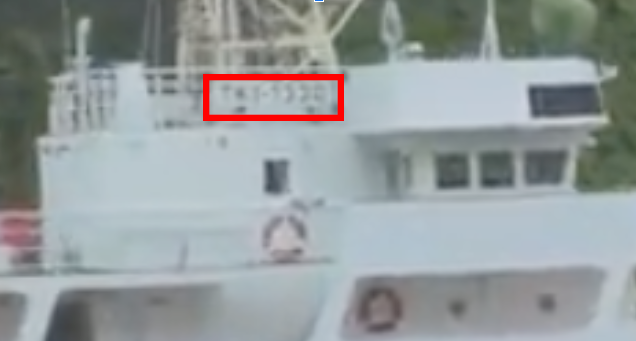
https://www.snopes.com/uploads/2020/12/tk1-1330.png?
>
<
https://www.tiktok.com/@hidden.on.google.earth/video/6876093871994998017?
>
<
https://www.youtube.com/watch?v%3DhvhvF7N4GI
>
is
?:
itemReviewed
of
claimskg:
claim_review/3d94c4a2-ca01-5b1e-8a2f-cdde3209e707
?:
keywords
claimskg:
keyword/9525ed32-130c-5b03-9dcb-b0fbe0474b19
claimskg:
keyword/b8427a11-d432-5386-bf2f-d7b496d2eab2
claimskg:
keyword/f82d2548-65d1-57fc-b993-c0bfe598b7d5
?:
mentions
claimskg:
mention/71c17fcf-3bd7-5fd1-9ff7-fda039f9aa60
claimskg:
mention/a869dca3-85c2-50d6-887e-25080516779a
claimskg:
mention/bca2963b-16db-5eed-bf2b-8e23a388ea99
claimskg:
mention/fa7c1805-b92c-563a-a6d2-1467b3e6d233
?:
text
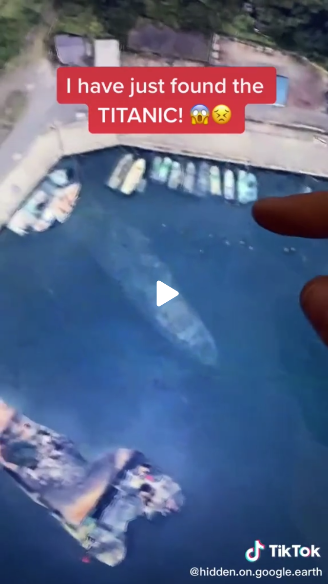
Satellite imagery used in Google Earth and Google Maps reveals a sunken ship in a port on a Japanese Island.
(en)
rdf:
type
<
http://schema.org/CreativeWork
>